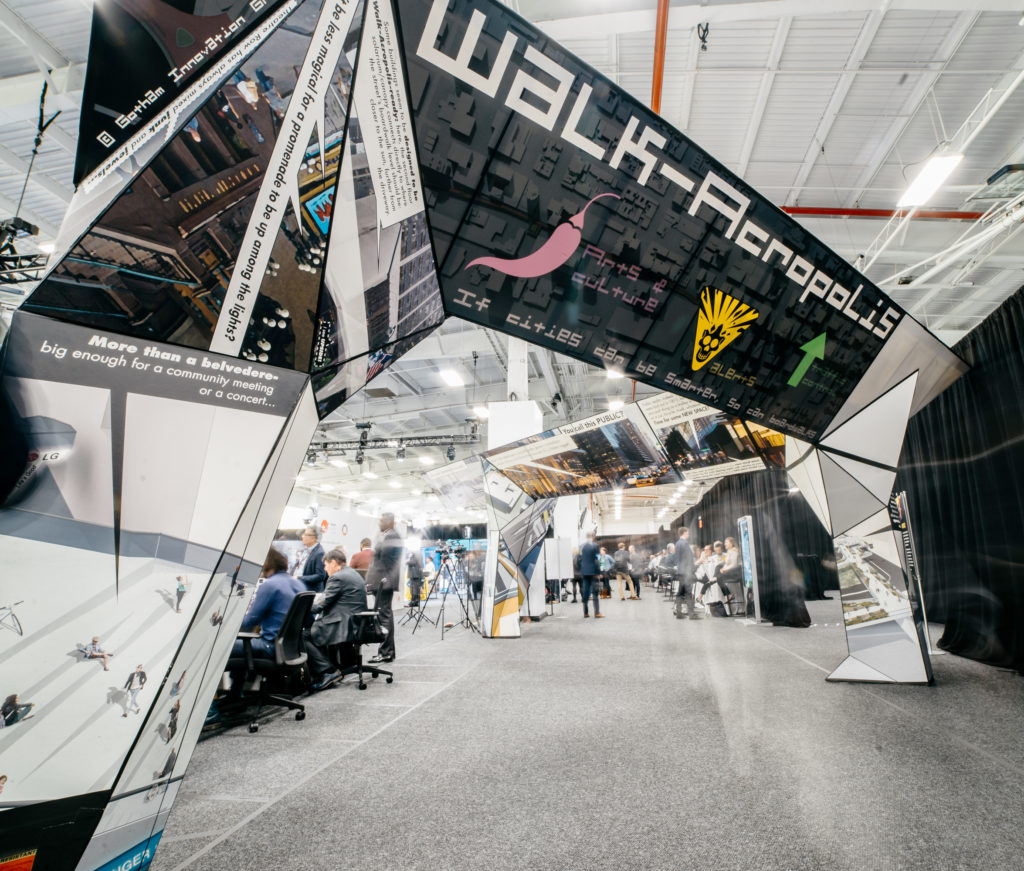
WalkAcropolis
The idea: a civic and civil piano nobile design framework for urban arterial streets, with open public “unsquares” above intersections. Reduced competition between pedestrians and vehicle traffic increases the transport capacity of the exisitng roadway, while the continuity of the rambla above provides for a more congenial experience, as well as pedestrian circulation whose increased efficiency (no waiting at traffic lights) greatly improves the speed and therefore range of walking as “active transport”. Moving pedestrians up 6 meters from grade level brings them closer to the sun and meaningfully further from the immediate hazard of vehicle collisions as well as the longer-term hazard of exhaust fumes. It also raises them to the first upper-story level of buildings facing the street, thus providing for a doubling of the retail frontage of commercial properties, neatly offsetting the cost and nuisance of contruction and permanent obstructions like stairs and columns. The deck’s faces, undersides, and supports can carry digital media in real time for a full spectrum of program types from revenue-generating signage for adjacent retail to smart traffic signals, public service information, wayfinding, and cultural programs.
The experiential strategy: media “skins” on the decks’ faces and undersides combine advertising, public information, traffic control, and lighting for both safety and spectacle; the upper deck provides for a re-emphasis of the bulevard as a lively enchaînement of civil civic spaces, the kinds of places in which broad citizen participation in thoughtful governance might not be counter-intutitive.
The technical strategy: digitally designed asymmetrical metal box trusses installed by crane and bolted together on-site with minimal disruption of traffic, with enough conduit space in column and deck assemblies to provide for the next few generations of IT infrastructure. Because the structures will carry little more than people and their own weight, they can be designed with relatively light structures even where long unsupported spans are required to bridge boulevard intersections or circumvent heritage buildings, or where there are large gaps between suitable locations for footings.

The scenario: to test the concept, a hypothetical deployment– the entire length of 42nd Street in Manhattan, from the Intrepid Museum and ferry station at the Hudson river to the United Nations, FDR drive, and East River’s edge. 42nd Street, like most of Manhattan, was laid out in 1811… before there was such a thing as a car, a subway, a skyscraper, a tractor-trailer transport truck, or a tourist with a camera. It would be an easy half-hour walk without the many traffic lights; It is actually often a 45-minute drive, as one of the few two-way river-to-river crosstown streets in midtown. Within the street’s total length of two miles (3 Km), the WalkAcropolis connects the Intrepid museum, the west side ferry terminal, Hudson river park, the Lincoln tunnel access, the Port Authority bus terminal, Times Square, Bryant Park, the New York Public Library, Grand Central Terminal, Tudor City, the United Nations… plus a dense mix of shops, restaurants, hotels, offices, and homes. Doubling this public realm “pencils out” nicely.

The reality level: in all honesty, we first approached this project as something somewhere between “blue sky” and “sci fi”… were we making performance art about urbanism? Apparently not. first, people who ought to know started taking the idea literally, then seriously.

As of this writing, I am preparing, with Patrick Bermingham and Jee Won Kim, to present the WALKACROPOLIS in Venice. Stay tuned, we may yet be called upon to build one somewhere in the world. Thanks to Patrick’s long years at the head of a heavy construction engineering consultancy, he have been able to verify that the idea “pencils out” much better for densely developed urban cores than conventional transportation/circulation “infrastructures” at every level: initial buildability, operational sustainability, and support of new levels of resilience, capacity, and operational viability for the built public realm.
